Inductive Loops vs LiDAR Technology for Traffic Detection and Actuation
.png "Untitled design (3)")
For signalized intersection operations over the last several decades, inductive loop technology has established itself as the leading traffic detection and actuation technology, primarily because no other above-ground detection technology has been able to match loop accuracy when they are properly tuned and maintained. Developed specifically to detect the presence of stopped vehicles at intersections, they are the most ubiquitous traffic sensor on the market today.
However, the evolving needs of cities and transportation agencies, combined with the continuous advancement of technology, have led to the development of many superior technologies that can detect multiple types of road users, optimize traffic flow, and introduce more advance traffic signal operation functions.
Drawbacks of Inductive Loops at Intersections and on Highways
While inductive loops have helped improve detection, contributing largely to more coordinated corridor traffic flow, they present several significant functional disadvantages:
- They are costly to install and to maintain
Installing inductive loops requires cutting into the pavement to lay the loops of wire below the asphalt. On top of requiring lane closures, this process is labor-intensive, involves specialized equipment to ensure precise placement, and disrupts traffic operations during the installation process. This contributes to overall loss in productivity. - They are subject to breakage
Because inductive loops must be installed in-pavement, they require close monitoring and maintenance over their lifespan in order to remain operational. Most loops only remain in operations between 3-7 years before having to be replaced. Some common weaknesses include:
-
- Sensitivity to environments with freeze/thaw seasonal cycles which contribute to loop breakage.
- Subject to water intrusion, which then degrades and/or freezes and breaks the loop.
- Subject to breakage during pavement resurfacing operations and must be replaced, at an additional cost
- They cannot distinguish between types of vehicles
Inductive loops can sense vehicle presence, but are incapable of vehicle classification. - They cannot detect vulnerable road users such as pedestrians and cyclists
Inductive loops cannot detect pedestrians and vulnerable road users, which adds costs to vehicle count and classification efforts by 3rd parties utilizing temporary, passive technology.
- They do not provide traffic data and analytics
Incorporating multimodal data into traffic optimization efforts enables cities to create a more efficient, safe, and sustainable transportation environment, enhancing the quality of life for all residents.
LiDAR Technology
LiDAR (Light Detection and Ranging) technology is increasingly being used at intersections to detect, classify, and analyze road users for improved traffic actuation and intersection management.

.png "Untitled (1200 x 800 px)")
How LiDAR Works at Intersections
- Detection of Road Users:
- High-Resolution Mapping: LiDAR sensors emit laser pulses that bounce off objects and return to the sensor, creating a high-resolution 3D map of the environment. At intersections, this allows for the most precise detection of all road users, including cars, buses, trucks, cyclists, and pedestrians.
- All-Weather Functionality: Unlike cameras, LiDAR is not affected by lighting conditions (like darkness or glare) and can function effectively in various weather conditions, including fog, rain, or snow.
- Classification of Road Users:
- Object Differentiation: LiDAR systems use algorithms to differentiate between different types of road users. They can identify and classify objects based on size, shape, and movement patterns, distinguishing between cars, trucks, bicycles, and pedestrians.
- Behavior Analysis: Beyond simple classification, LiDAR can analyze the behavior of these road users. For instance, it can detect whether a pedestrian is waiting to cross the road or if a vehicle is preparing to make a turn.
- Real-Time Analysis for Traffic Actuation:
- Dynamic Signal Control: LiDAR provides real-time data that can be used to adjust traffic signals dynamically. For example, if the system detects a group of pedestrians waiting to cross or a queue of vehicles building up, it can extend green light durations or prioritize certain movements to reduce delays.
- Conflict Detection: By continuously monitoring the intersection, LiDAR can detect potential conflicts, such as a vehicle running a red light while pedestrians are crossing. This information can be used to trigger alerts.
- Data Collection and Long-Term Analysis:
- Traffic Flow Monitoring: LiDAR collects detailed data on traffic behavior over time. This data can be analyzed to identify trends, peak usage times, and areas of congestion, allowing for more informed decision-making in traffic management.
- Safety Enhancements: The data from LiDAR systems can also be used to improve intersection design and safety. For example, if the technology consistently detects vehicles which remain in turning queues after a signal phase has ended, a traffic engineer may examine and adjust traffic signal timing to allow more turning vehicles.
Benefits of Using LiDAR at Intersections
- Precision: LiDAR’s high-resolution mapping allows for the precise detection and tracking of all road users, leading to more accurate traffic management.
- Easy to install and maintain: Installed above ground, this type of system is non-intrusive and doesn't require any lane closure in order to be installed or maintained.
- Safety: By detecting and classifying road users in real-time, LiDAR can help cities enhance the safety of intersections, reducing the likelihood of accidents. Read our case study here.
- Efficiency: LiDAR enables more responsive traffic signal control, reducing wait times and improving traffic flow.
- Scalability: The data collected can be used to optimize not just individual intersections but entire traffic networks, leading to city-wide improvements.
LiDAR: A Cost-Effective Alternative to Inductive Loops
In summary, Inductive loops have been a popular choice for about 60 years and have been adopted in many countries. They accurately provide information about the number of vehicles that have passed over the loops’ detection area and can be integrated into traffic signal controllers for traffic actuation. On the other hand, inductive loops cannot provide information about the type of road user, speed, trajectories and other detailed traffic information that is vital for improving road safety. They are also expensive to install and maintain.
SIMPL is a comprehensive and cost-effective solution to detect and analyze the presence of all road users. Real-time data can be shared with the city planners as well as traffic signal controllers for optimized actuation.

SITUATION
Seyond set out to confirm the accuracy of its SIMPL solution using two sensors and a sophisticated perception software. This test was done to compare the accuracy of Seyond’s SIMPL solution against two existing inductive loops.
SOLUTION
Two Falcon Prime LiDAR sensors running on FW4464 were installed on a cement pole at the corner of the intersection along with a POC edge box running our perception software (v1.3).
RESULTS
The LiDAR-based solution had a 99% accuracy rate

SITUATION
For days, HubSpot manually tracked marketing metrics using Excel, Google sheets, and complex macros
SOLUTION
Logoipsum partnered with T2D3 to document their entire customer journey and map metrics at each stage
IMPACT
Logoipsum increased data accuracy by 76% and decreased manual data collection time by 4 hours per week
Got a question?
Is LiDAR reliable?
Lorem ipsum dolor sit amet, consectetur adipiscing elit, sed do eiusmod tempor incididunt ut labore et dolore magna aliqua. Ut enim ad minim veniam, quis nostrud exercitation ullamco laboris nisi ut aliquip ex ea commodo consequat. Duis aute irure dolor in reprehenderit in voluptate velit esse cillum dolore eu fugiat nulla pariatur.
What’s involved in installing SIMPL at an intersection?
Installing SIMPL is straightforward. The system requires mounting two LiDAR sensors on existing infrastructure such as poles or traffic light arms. Our team provides detailed guidelines for positioning and alignment to ensure maximum coverage. The edge processor, which powers the software, is installed directly at the intersection and easily connects to existing power and communication systems.
How does SIMPL integrate with existing traffic management systems?
SIMPL is designed to seamlessly integrate with standard traffic management systems. It can connect to controllers and traffic signal systems using open communication protocols, ensuring compatibility with both legacy and modern ITS infrastructure. Our software also supports various output formats for easy data exchange.
How accurate is SIMPL in detecting road users?
SIMPL’s LiDAR-based system offers unmatched accuracy- 99% in detecting vehicle at the stop bar and over 92% in detecting pedestrians at high-density crosswalk. It detects and classifies all road users – vehicles, pedestrians, and cyclists – up to 100 meters beyond the stop bar, even in difficult conditions like rain, fog, or poor lighting. With real-time data processing, SIMPL provides precise information on counts, speed, size, and safety of all road users.
What maintenance is required for SIMPL?
SIMPL is designed for minimal maintenance. The LiDAR sensors are weather-resistant and perform well in harsh conditions without requiring frequent recalibration. Regular checks can be conducted remotely via the software, and any necessary cleaning or adjustments are easy to perform on-site.
Can SIMPL handle extreme weather conditions?
Yes, SIMPL is built to perform reliably in all weather and lighting conditions. Whether it’s bright sunlight, heavy rain, fog, or complete darkness, our LiDAR sensors provide consistent, accurate data, ensuring that traffic detection remains precise no matter the environment.
What is the typical lifespan of SIMPL hardware components?
The hardware components of SIMPL, including the LiDAR sensors and edge processor, are designed to last between 5 and 7 years under normal operating conditions. The equipment is durable, resistant to weather, and built for long-term use with minimal maintenance. An extended warrantee can be purchased for extra peace of mind.
What are the power requirements for SIMPL?
SIMPL operates using standard power supply options typically available at intersections. The LiDAR sensors consume 35W of power and require an input voltage of 9 to 34 V DC (24V recommended). The edge processor is energy-efficient, and the sensors require minimal power to function. In many cases, it can be powered through existing infrastructure without needing additional power installations. For more information, see our product datasheet.
What support is available if there’s a problem with the system?
We provide comprehensive support for installation, integration, and ongoing maintenance. Our team is available for troubleshooting, and we offer remote diagnostics to quickly identify and resolve any issues. Additionally, regular software updates ensure the system remains optimized and secure.
IS SIMPL NEMA TS2 Certified?
Yes. Our NEMA TS 2-2021 certified FALCON LiDAR sensors ensure reliable and industry-standard performance, providing confidence in safety and durability for all-weather and all-lighting conditions.
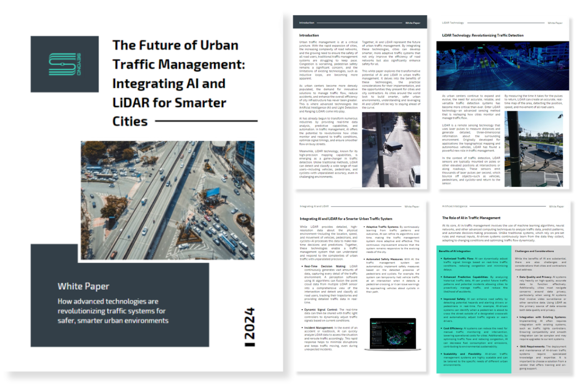
THE FUTURE OF URBAN TRAFFIC MANAGEMENT: USING LiDAR and AI for Smarter Cities
Download our white paper on how advance technologies are revolutionizing traffic systems for safer, smarter urban environments.